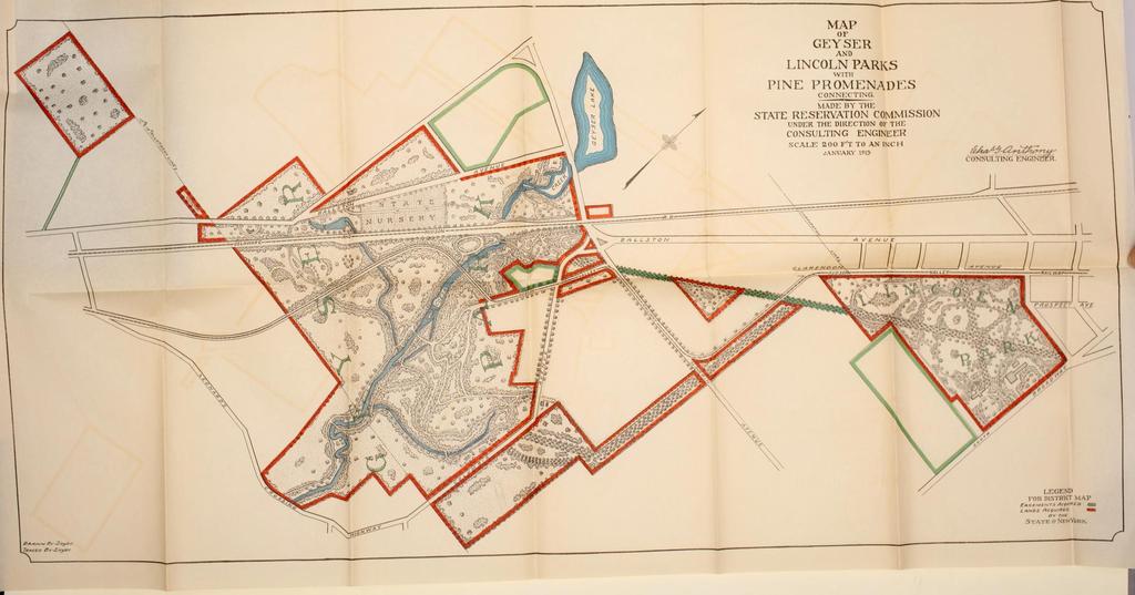
Maps and plans of the Saratoga Performing Arts Center have helped planners, staff members and audience members get to, get around and get to know the Center since the earliest planning stages. Here are a selection of maps from the SPAC archives that show just what maps can do to connect people and place
From the Beginning


Many know Saratoga Springs’ informal motto — and brand — of “Health, History, Horses.” The town thrived as a tourist draw starting with early 1800s visitors to mineral springs and expanding over the decades with the arrival of the railroad (built mainly by Irish and Italian immigrants) and the building of lavish hotels and churches (often staffed by those same immigrants and African-Americans).
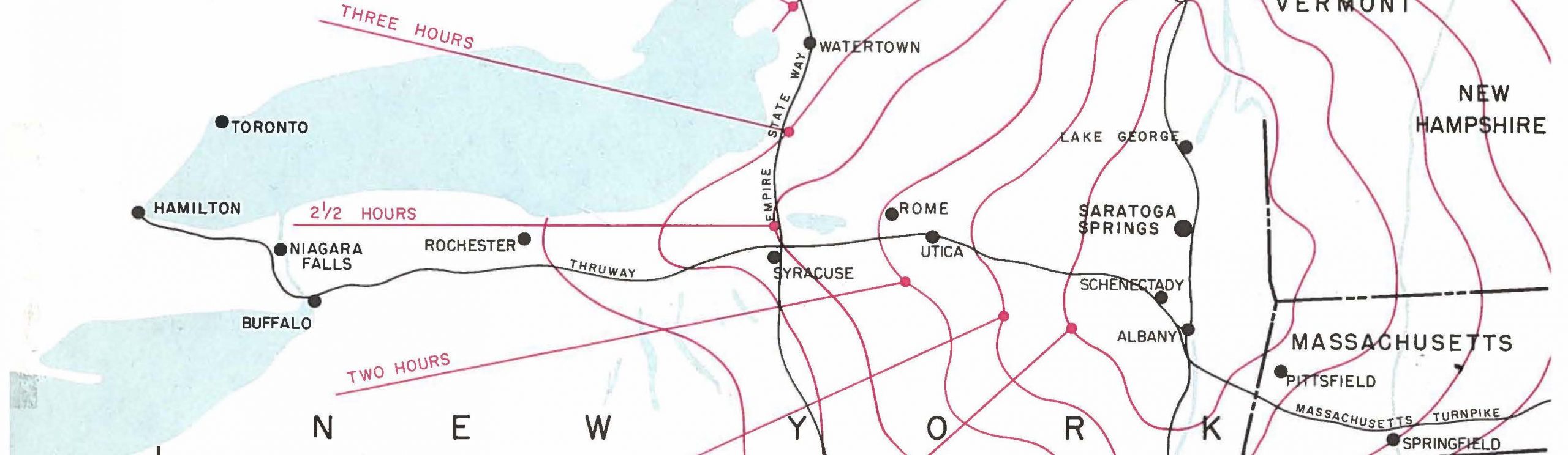
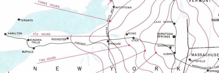
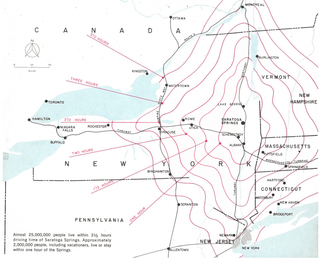
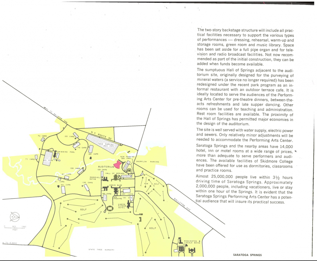
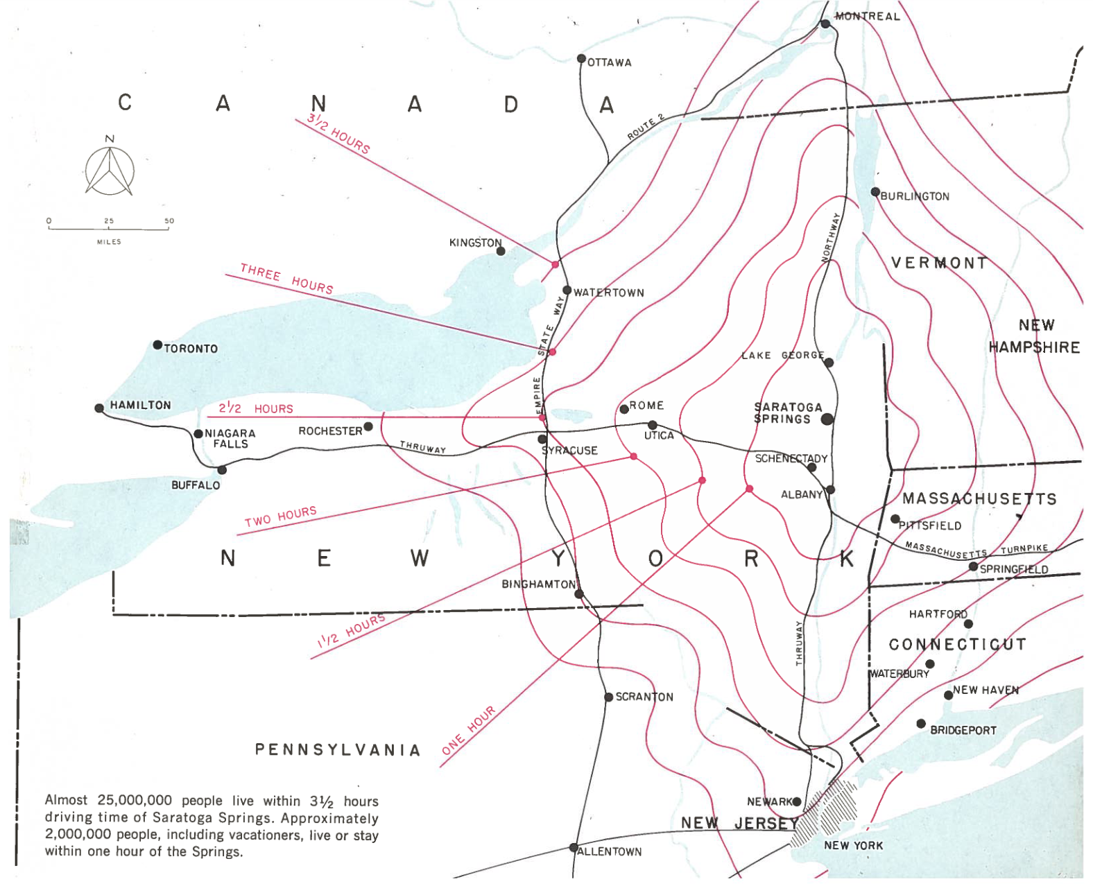
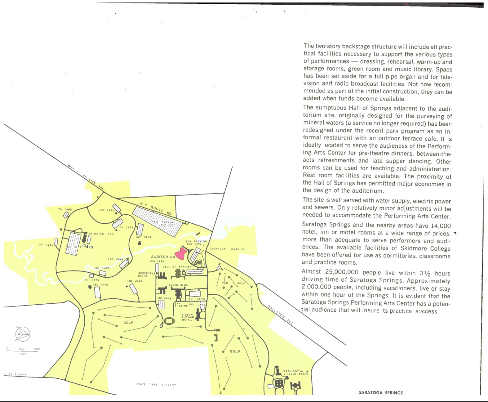
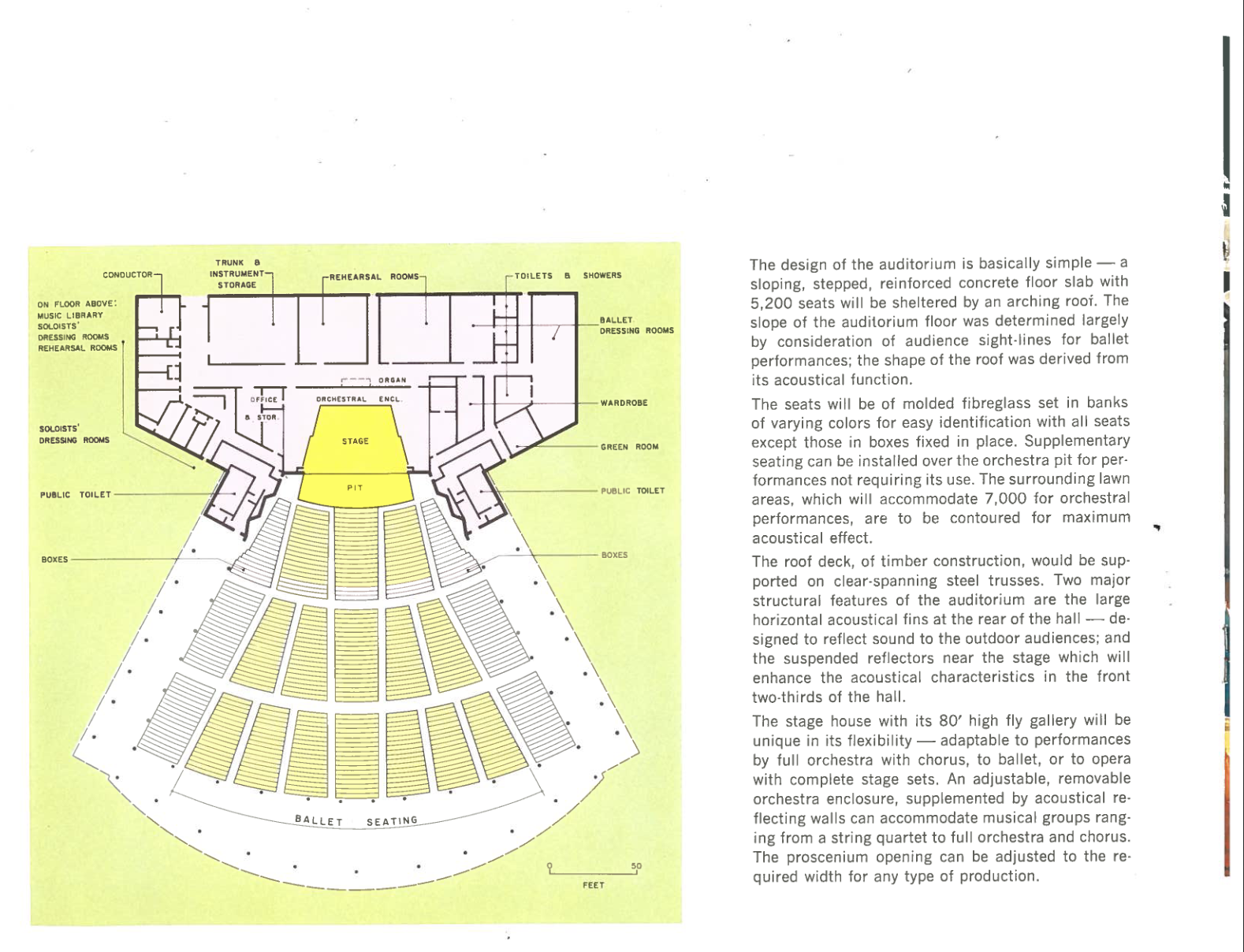
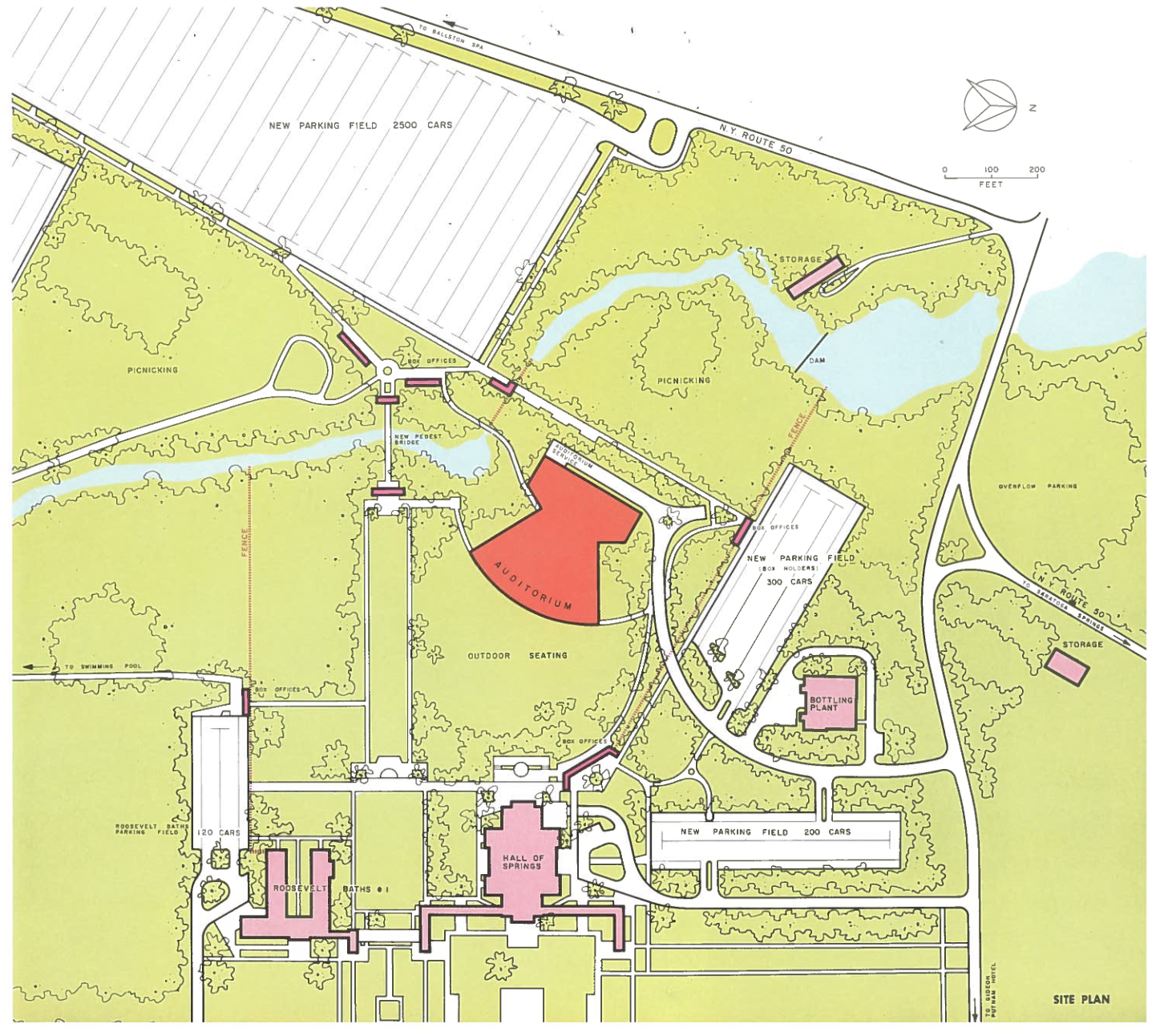
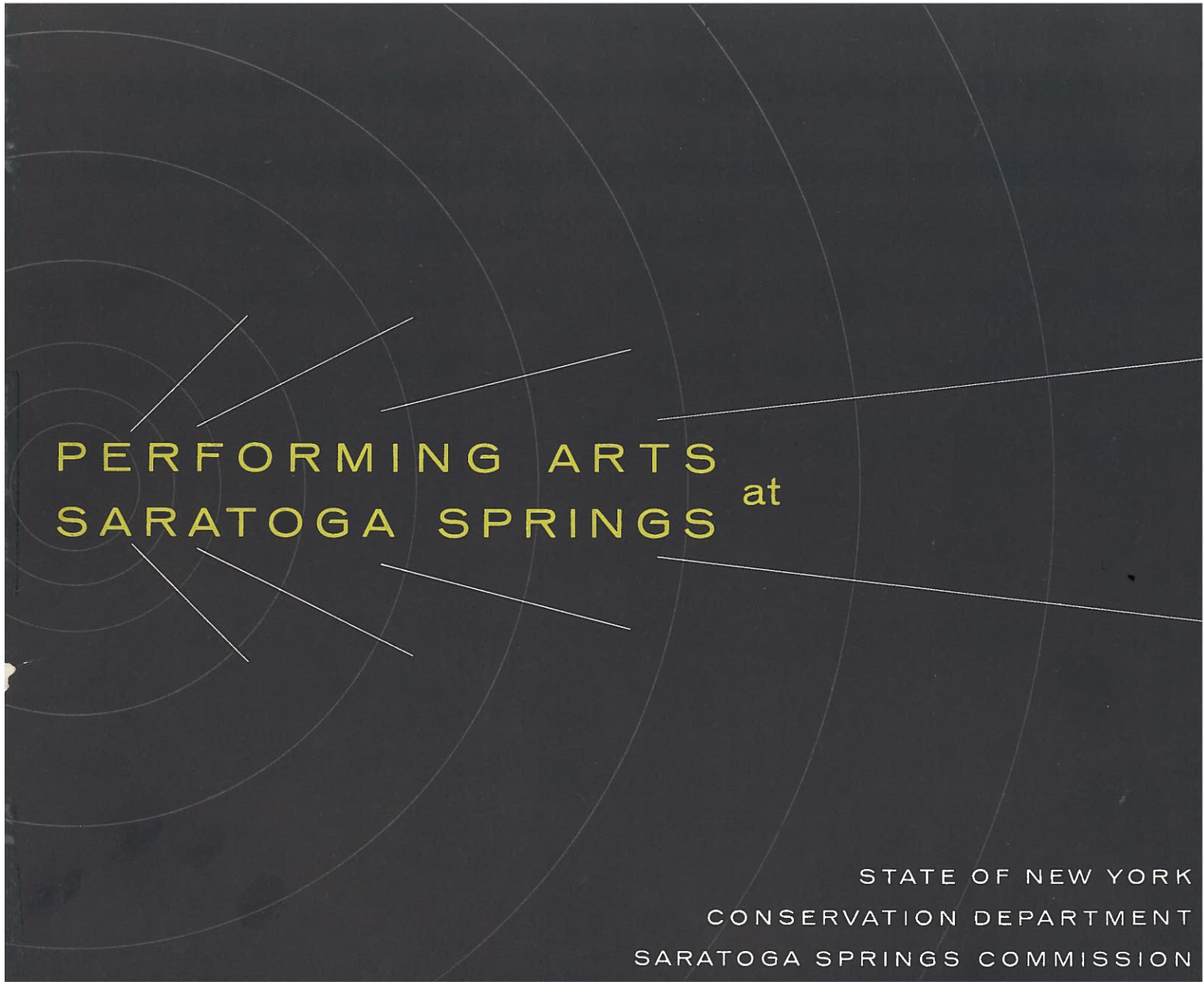
To foster support to this vision, the New York Conservation Department and Saratoga Springs Commission prepared four maps in a 1965 brochure, Performing Arts at Saratoga Springs (at right) . A regional map highlighted how big an audience could be attracted — in those automobiles — from Montreal to Buffalo to New York City to Springfield, Mass. A plan of the auditorium showcased an ample backstage for performers. Two sketch plans set the building in context: the SPAC complex with new parking lots and existing structures, of as an anchor to the park’s many spaces, from Lincoln Baths to Gideon Putnam Hotel.
Activities
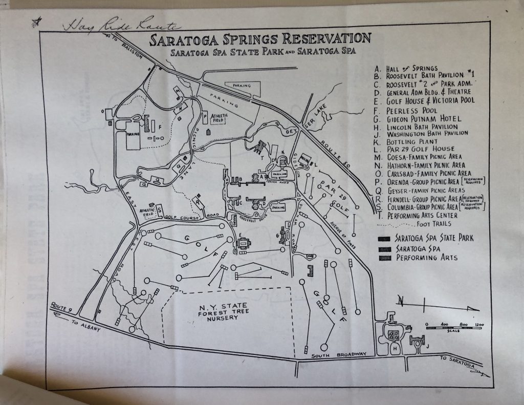
Hay Ride route through the park 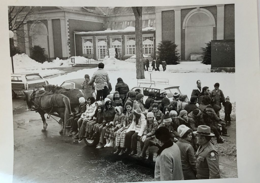
Hay Ride at the Hall of Springs.
Over the years, visitors to SPAC have not only attended conferences, but explored the SPA State Park. The Winter Festival, a popular mid-1970s program, offered two activity maps: a ski race trail and hayride route. Both underline the importance of place to the Center — neither activity could take place in the amphitheater. The 1975 hayride route map through the “Saratoga Springs Reservation” highlights the usual summer stops — picnic areas, springs, pavilions a golf course, and the Performing Arts Center — at odds with a photograph of the riders near snow piles at the Hall of Springs.
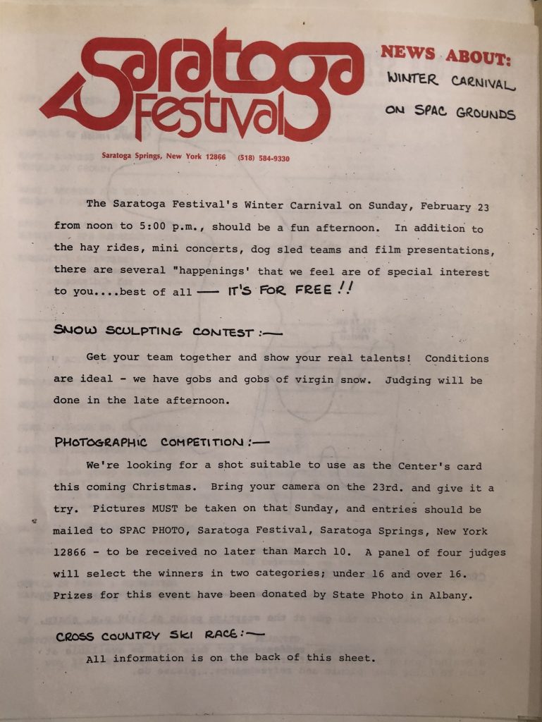
It’s free! 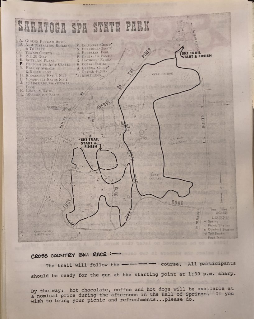
Ski Race route, 1975. 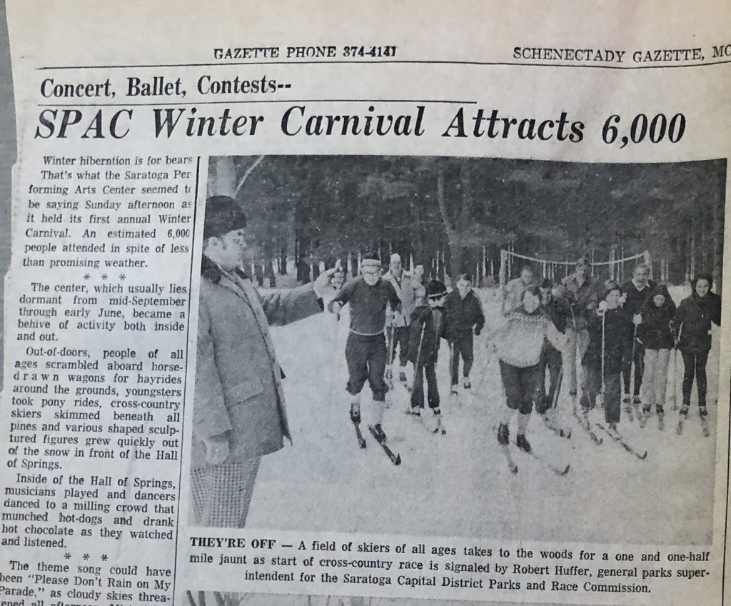
Ski Race, 1975
Updates and Upgrades
1977 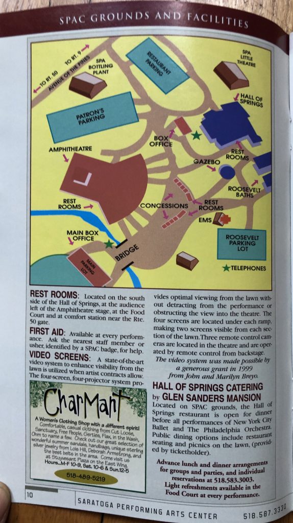
2010 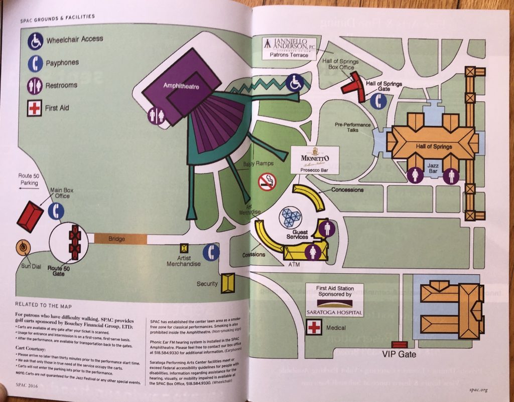
2016 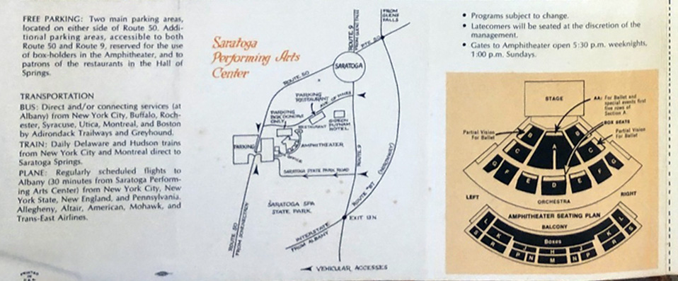
1968 Summer Program, detail.
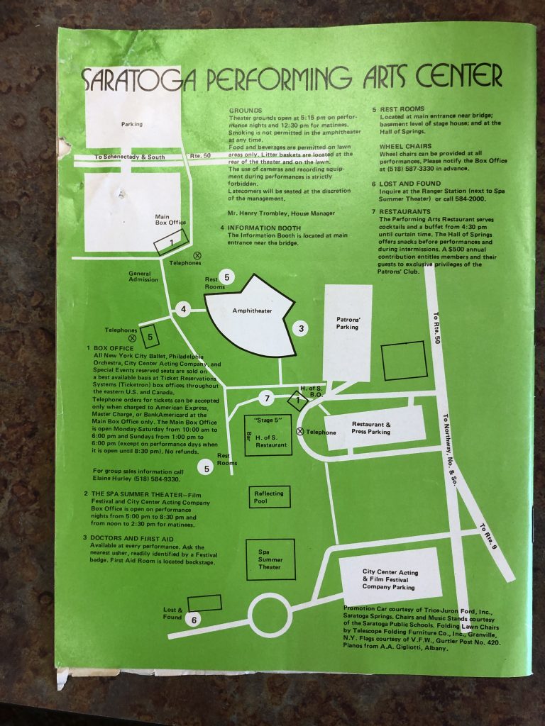
As the years passed, SPAC expanded, adding concession areas, a ticket booth and an exit and parking lot at Route 50. Architectural plans again showcased where change could and would happen, and SPAC’s event programs put the new amenities on the map for audiences. For on-site attendees, it was less important to show SPAC as part of a network of roads and spaces that encouraged people to hop in a car or on a train to wend their way to a performance and the Spa State Park. Rather, the maps helped people to plan a route from within Saratoga Springs or from the Gideon Putnam Hotel in the Spa State Park, to navigate the amenities in and around the amphitheater, and to pick their seats. The two-tone color of the early programs ceded, by the 1990s and 2000s, to multi-color layouts that reflected changing design styles and print technologies and also highlighted vendor and sponsor logos.
Learn more about maps and Saratoga Springs at the Skidmore-Saratoga Memory Project, “Mapping Saratoga Springs”
J. Dym, Professor, Dept. of History